Distributed, online workshops to discuss best practices and potential standardization of map viewers built using the web platform
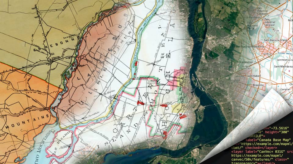
Maps of Montreal, past, present, and future. Maps for the Web, Sept−Oct 2020, #Maps4HTML

Workshop Agenda

Workshop particpants are invited to join the workshop gitter chat to exchange information with other participants, and the program committee. You'll need either a GitHub, GitLab or Twitter account to join.

The workshop series consists of scheduled video conference sessions (presentations, panel discussions, and in-depth breakout discussions) and asynchronous written discussion.

The video conference sessions are grouped into blocks of 2 hours per day, and scheduled at different times each day to accomodate all time zones. Registered participants will receive an email with links to the video conference sessions. Videos of the workshop presentations and panels will be posted to the discussion forum. Participants can watch at their own schedule and leave written contributions.

Breakout topics (45 minutes to 1 hour each) are scheduled following many of the main daily sessions, using the same video conference format. These sessions will allow smaller groups of interested workshop participants to hack on a technology or get a deeper understanding of a topic. Facilitators will start with a demo or tutorial of their project, and then open the discussion for questions and suggestions.

Due to risks associated with global travel and the spread COVID-19, the Maps for the Web workshop series in 2020 was online only, using a distributed, asynchronous model to encourage in-depth participation regardless of time zones.

Schedule

  1. Introduction presentations 30 minutes
    Welcome
    The workshop program committee
    Talks
    Why maps for the web : Peter Rushforth position statement
  2. State of Web map widgets today presentations 1 hour
    Talks
    Use Cases Amelia Bellamy-Royds
    Geomoose : Dan Little position statement
  1. State of map data & server standards today presentations 1 hour
    Talks
    OGC APIs for web use Gobe Hobona
    pygeoapi Tom Kralidis, Angelos Tzotsos, Francesco Bartoli
    Connection of the MapML initiative with OGC standards such as the new OGC API Tiles candidate or the old WMS Joan Masó
    Limitations to use of OGC services Jonathan Moules
  2. Stakeholders: Government geospatial data providers & the web panel 1 hour
    Panelists
    Emilio López Romero, National Centre of Geographic Information (Spain)
    Cameron Wilson, Canadian Spatial Data Infrastructure
    Don Sullivan, NASA
    Sébastien Durand, Canadian Federal Geospatial Platform
    Moderator
    Peter Rushforth
    Discussion
    Web mapping needs for Government Geospatial data providers, on Discourse
  1. Native map viewer for the Web platform presentations 1 hour
    Talks
    Extending the Web: Maps, The Commons, and Pie : Brian Kardell position statement
    The MapML Proposal - Part One : Peter Rushforth position statement
    Bocoup's Review of the MapML Proposal : Simon Pieters position statement
    Quad Tree Composite Tiling and the standardization of tiling; Decentralized Web Mapping : Satoru Takagi position statement
  2. Internationalization and Security presentations 30 minutes
    Talks
    Multilingual text rendering Brandon Liu
    Fuzzy Geolocation Thijs Brentjens
  3. Worldwide Web Maps: Challenges in the global context panel 30 minutes
    Panelists
    Brandon Liu, Protomaps
    Siva Pidaparthi, ESRI
    Nicolas Rafael Palomino
    Thijs Brentjens, Geonovum
    Moderator
    Doug Schepers
    Discussion
    Worldwide Web Maps: Challenges in the global context, on Discourse
  4. Extending GeoJSON for Web Applications breakout
    Facilitator
    Gethin Rees
    Talks
    Expressing GeoJSON as JSON-LD 1.1 : Bryan Haberberger joint position statement
    GeoJSON-T: Adding time to the GeoJSON standard Karl Grossner
    Discussion
    Extending GeoJSON for Web Applications, on Discourse
  1. Creating accessible Web map widgets presentations 30 minutes
    Talks
    UI patterns in existing web map widgets Nic Chan
    Introduction to Digital Nonvisual Maps : Brandon Biggs position statement
  2. Building Cross-Sensory Maps Using Audiom breakout 60 minutes
    Facilitator
    Brandon Biggs
    Discussion
    Digital Nonvisual Maps, on Discourse
  3. The <map> and <layer> speculative polyfill (MapML) breakout
    Facilitator
    Peter Rushforth
    Talks
    The MapML Proposal - Part Two : Peter Rushforth position statement
  1. Web Maps for Real-World Accessibility presentations 30 minutes
    Talks
    Physical accessibility data in maps Sebastian Felix Zappe
    Indoor maps Claudia Loitsch & Julian Striegl
  2. Web Maps for Cognitive Accessibility panel 30 minutes
    Panelists
    Lisa Seeman
    David Fazio
    John Kirkwood
    John Rochford
    Moderator
    Amelia Bellamy-Royds
    Discussion
    Cognitive Accessibility of Web Maps, on Discourse
    Background Reading
    COGA Issue Paper on Indoor Navigation / Wayfinding
    Collection of Wayfinding links & resources
  3. Building better map data services/formats for web use presentations 60 minutes
    Talks
    Advanced Analytics Software Project for Geospatial Data Nicolas Rafael Palomino
    Embedding rendering & behavior configuration in map data Danielle Dupuy
    The History of Meteorology and Cartography : Chris Little position statement
    Web GIS application for Indian Prime Minister's Rural Road Programme : Sajeevan G position statement
  1. Creating accessible Web map widgets presentations 20 minutes
    Talks
    Towards Accessible Annotations for a Native Map Viewer for the Web Platform Nicolò Carpignoli & Joshue O Connor
  2. Creating accessible Web map widgets panel 30 minutes
    Panelists
    : Brandon Biggs, Audiom / Smith-Kettlewell Eye Research Institute position statement
    Doug Schepers, Fizz Studio
    Tony Stockman, Queen Mary University
    Nicholas Giudice, University of Maine
    Moderator
    Gobe Hobona
    Discussion
    Creating accessible web map widgets, on Discourse
  3. Advances in 3D Map Display presentations 30 minutes
    Talks
    GeoPose: From point-of-interest to maps-of-objects Jan-Erik Vinje
    How GeoPose aligns with use cases and requirements for Web map authors Christine Perey and Josh Lieberman
  4. Maps and augmented reality panel 30 minutes
    Panelists
    Christine Perey, OGC GeoPose working group
    Jan-Erik Vinje, Open AR Cloud Association
    Ada Rose Canon, Samsung
    Patrick Cozzi, Cesium Inc.
    Thomas Logan
    Moderator
    Ryan Ahola
    Discussion
    Maps & Augmented Reality, on Discourse
  5. Maps of Objects: GeoPose for Web maps breakout
  1. Advanced web graphics for mapping presentations 60 minutes
    Talks
    Map adventures in weird web standards - gyroscopes, texture cubes, and mutants : Iván Sánchez Ortega position statement
    Map Compositions format : Karel Charvat position statement
    MapML implementations in MapServer, GDAL and OGR Daniel Morissette
    OffScreenCanvas for rendering performance Andreas Hocevar
    Dynamic and Observational Spatial Data : Thomas Usländer, Hylke van der Schaaf, Katharina Schleidt joint position statement
  2. Stakeholders: Commercial mapping services & the web panel 1 hour
    Panelists
    Johannes Lauer, HERE
    Thomas Lee, Mapbox
    Daniel Lewis, Geotab
    Ed Parsons, Google
    Moderator
    Ted Guild
    Discussion
    Stakeholders: Commercial Mapping Services on the web on Discourse
  3. Map Whiteboard: Collaborative Map-Making breakout
    Facilitator
    Karel Charvat
    Discussion
    Map Whiteboard: Collaborative Map-Making on Discourse
  1. Web developer priorities presentations 20 minutes
    Talks
    User Research on Maps in HTML : Terence Eden position statement
  2. Stakeholders: Open Source for Web Mapping panel 1 hour
    Panelists
    Andreas Hocevar, OpenLayers
    : Simon Pieters, Bocoup position statement
    Will Mortenson, NGA
    Daniel Morissette, MapGears
    Moderator
    Tom Kralidis
    Discussion
    Stakeholders: Open Source for Web Mapping on Discourse
  3. Conclusion / Next Steps discussion 30 minutes
    Talks
    Conclusions and take aways The workshop program committee

Discussion will continue online through the month of October, in the hopes of gaining wide input towards a consensus on key issues. In late October, moderators will post final calls for consensus, summarizing the conclusions of each discussion. These summaries will then be integrated into a workshop report.

Instructions for participants

The workshop series focuses on topics raised by participants in expressions of interest and position statements. Each topic will be introduced by one or more short (or lightning) talks, or an expert panel, and is then discussed among participants in the forums. The goal of each workshop discussion is not to resolve all technical issues of the topic, but to determine its relevance and priority to standardization.

Session Formats

presentations

Presentations are grouped by theme, to introduce topics for discussion. Talks are short (<15 minutes each) and focused on introducing specific work or proposals.

If time is available during the live video conference, some questions and discussion may follow the talk. Further questions and comments are encouraged in the online discussion.

panel

Moderated panels provide an opportunity for more free-ranging discussion on a theme. Speakers are selected in advance by the program committee; an assigned moderator will introduce the speakers and coordinate the discussion.

The panel discussions are only the start: the topics they introduce will be the start of open discussion online, where all workshop participants are encouraged to exchange ideas, assess priorities, and identify possible standardization actions. The moderator will be tasked with keeping the discussion on topic, and identifying areas of consensus for the final workshop report.

breakout
hack

These sessions will support more collaborative discussion by smaller groups. Breakout sessions will cover more specific technical topics that didn't fit into the main workshop schedule. Hack sessions will welcome new collaborators to a software or data project, as discussed in the call for participation.

The specific format will depend on the topic and goals of the session, but could include a mix of video presentations, live chat, and written discussion. Regardless of format, each group is expected to provide a written summary of their session.

Maintaining records

All session organizers are expected to create records of what was discussed, what conclusions or consensus was reached, and any major areas of discussion or concern.

Breakout session organizers will be able to use the W3C's IRC server and meeting-management bots. See tips on IRC at W3C.

Suggested Reading

If you can, please review the participant position statements and other background material before the workshops.