

SWAD-Europe Workshop on representing geographic
information in the semantic Web, 4 and 5 October 2004, Budapest, Hungary.
Agenda | Location | Registration | Minutes | Suggested Readings | Logistics
Nearby: SWAD-Europe events page
This workshop is being run by the SWAD-Europe project . The primary goals
of the workshop are to:
- Bring together developers working on the use of geographic data in the
semantic web.
- Provide a brief survey of available tools, development projects, and
areas where further development would be useful.
Please note that this workshop will be conducted entirely in English.
Provisional agenda
A more detailed agenda will be made available at the beginning of
October.
- Monday, 4 October: 09h30 - 13h00
- Setting up, Introductions
- Participants are asked to take a few minutes to introduce
themselves and explain the work they are doing or have done in
this area, and their interests
- Problems
- Identifying things which are currently difficult or apparently
not possible.
- Existing tools
- Gather information on existing tools in production use, that
are directly applicable to or could be applied to the problems
described. What do people do by hand, because it is easier?
- Lunch, 13h00
- To be provided
- Afternoon, 14h00 - 17h00
- Working examples
- Work in Progress, demonstrations, approaches being used or
tried.
- Vocabularies
- Are there a lot of different vocabularies interacting, or is
there readily emerging consensus?
- Dinner
- Progos, our hosts, have arranged for their annual garden party to
coincide with the workshop - so this will be the formal workshop social
event.
- Tuesday 5 October: 09h30 - 13h00
- RSS and HTML
- How far is it feasible to implement solutions that allow for
people using simple tools (blogs, wikis and web-based HTML
authoring tools for example) to incorporate interoperable
geospatial information in what they publish.
- Review
- Look at list of problems, vocabularies, tools, see if there are
others we want to tackle. Are there things we didn't think of
yesterday? Does a wider perspective on the problem suggest more
solutions, or more problems?
- Different names for the same place - scope, range and variety
- Are these seperate problems? Or are they manifestations of a
complex question whose solutions can be best found by looking for
the common threads?
- Lunch 13h00
- Again
- Afternoon 14h00 - 16h30
- Emerging topics
- What have we recognised as important topics for discussion?
- Development priorities
- What are people actually working on after this meeting? What is
missing from the available tools, or is more important than
current development efforts seem to recognise?
- Conclusions and closing
- Wrapping up - what we can expect to see from the workshop, what
follow up is useful?
 Progos.hu are handling the organisation of the workshop locally in
Budapest (as well as taking part).
Progos.hu are handling the organisation of the workshop locally in
Budapest (as well as taking part).
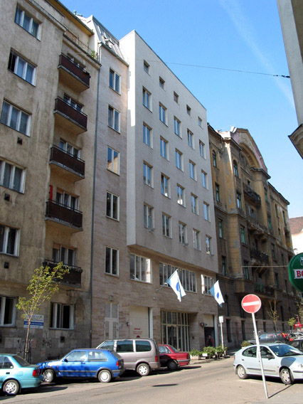
 The workshop will be at the Hungary
W3C Office, which is hosted by Sztaki, the
Computer Science department of the Hungarian Academy of Science. The address
is
The workshop will be at the Hungary
W3C Office, which is hosted by Sztaki, the
Computer Science department of the Hungarian Academy of Science. The address
is
1111 Budapest XI. Lágymányosi u. 11
and the Hungarian Office contact page
(in hungarian) includes pictures of where exactly the offices are (3rd
floor in the building)
Registration is free and open to the public, but required. Participants
must register before the 1st of October, using W3C's online registration.
Note: In order to use this system, you need a W3C site password - if you
are an employee of a W3C member organisation you are likely to have one
already, or can apply for one. Members of the public can get a public access password
online
According to the privacy policy for the
access password, your information will not be passed to anyone.
Numbers will be limited, and no places can be guaranteed for people who
have not registered. In general registration will be offered on a first-come,
first-served basis.
Participants are expected to provide a brief note (100 - 500 words) about
their relevant work and interest, and to attend both days of the workshop.
Participation in the workshop is free of charge, and coffee / lunch will be
provided, but participants must pay their own expenses (transport,
accommodation, etc).
A report of the workshop with links to more detailed records of the
discussion will be made available to the public after the workshop.
This list of readings will be updated in late September and again shortly
before the workshop.
Tools
- DAML.org airport lookup
- A service that returns RDF data about an airport, including its
location, given is IATA or ICAO code - for example http://www.daml.org/cgi-bin/airport?BUD
- RDF pointer
- A tool in SVG / javascript, designed to provide graphic user
interfaces for representing and producing geospatial information in
RDF. Under development as an open-source project at W3C.
- Nearest
Airport
- A simple tool from Morten Frederiksen that gives information about
the nearest airport given a latitude and longitude, or returns
information about an airport given its IATA code.
Projects
- ASDI
- Australian Spatial Data Infrastructure is a framework for linking
users and providers of spatial information.
- Dublin Core Metadata Intiative (DCMI)
- The Dublin Core is probably the most widely-known metadata schema,
and one of its recommendations is the Point
Encoding Scheme (designed for plain text / XML). Like most
schemes it includes the possiblity of using latitude/longitude
references. This vocabulary has been specified as an RSS 1.0
spatial module
- ESW GeoInfo wiki
- A wiki page that attempts to collect information on Geographic
information in RDF. As well as a number of useful links to sources of
geographic datasets and other relevant work, it describes the WGS84 lat/long/alt vocabulary
(an RDF Schema is also available).
See also the GeoOnion
page about a vocabulary for describing the size of a named place, or
the height
geo-extension for describing the height of a place in
terms of easily understood concepts (first floor above or below ground,
etc.)
- Geosemantics Interest Group Web
Portal
- A collection of useful information including ontologies describing
geographic information, problems and people working on them, etc.
- OpenGeospatialConsortium
- The OGC is an international consortium working on development of
standards for the exchange of geospatial information (the OpenGIS
specifications).
- PhotoRSS
- A project working on attaching location data to photographs, for RSS
feeds or Webpages.
- Space.frot
- A collection of work by Jo Walsh on representing geographic
information in RDF
Position papers
If you have any questions, please feel free to contact Charles McCathieNevile. I will try to answer as
fast as possible - email is generally the most effective channel.
A very good collection of information for visitors
to Budapest is available from Sztaki, including links to maps, taxi
companies, information on getting from the airport and getting around,
etc.
Budapest has an international airport with flights from many cities in
Europe. Budget airlines offering flights to BudaPest include Easyjet. There
are also trains and buses.
Money
Hungary uses the Forint (HUF). As of 16 September 1 euro was worth around
250 Forint.
Accommodation
Some suggestions are here - there are a number of others available via the
internet - try Hungarian Hotel
Guide or Budapest
Tourism Links:
Some hotels
| Name |
Type |
Approx. price
(room/night)
|
Notes... |
| Schönherz |
Student Hostel |
20€(7€/head/night) |
- Cheapest
- 10 minutes walk from workshop
|
| Marco
Polo |
Motel |
30-40€ |
|
| Sunlight |
Hotel |
40-50€ |
- 10 minutes walk from Progos
- great city panorama from the top of a hill
|
| Ventura |
Hotel |
60€ |
- 3km from Sztaki (direct tram connection)
|
| Flamenco |
Hotel |
100€ |
- 10 minutes walk from Workshop
- lakeside location
|
| Marriott |
Hotel |
200€ |
- City heart riverside location
- great city heart panorama
|
Charles McCathieNevile
Last modified $Date: 2004/09/29 14:03:21 $
 The workshop will be at the Hungary
W3C Office, which is hosted by Sztaki, the
Computer Science department of the Hungarian Academy of Science. The address
is
The workshop will be at the Hungary
W3C Office, which is hosted by Sztaki, the
Computer Science department of the Hungarian Academy of Science. The address
is Copyright (c) 2004 SWAD-Europe , All Rights
Reserved. W3C liability, trademark, document useand software licensing rules
apply. Your interactions with this site are in accordance with our public and Member privacy
statements.
Copyright (c) 2004 SWAD-Europe , All Rights
Reserved. W3C liability, trademark, document useand software licensing rules
apply. Your interactions with this site are in accordance with our public and Member privacy
statements.