IV.Building the 3-Dimensional Software Models of Crater Lake or Terrain and Topography:
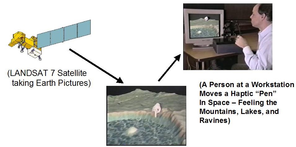
Caption: The LANDSAT 7 Satellite takes a picture of Crater Lake Oregon
then a person at a workstation moves a haptic "pen" in space - feeling the
mountains, lakes and ravines.